Hurricane Helene Approaches Florida: NOAA Warns of Catastrophic Inland Flooding Risks
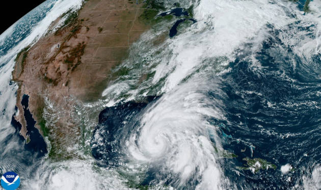
As Hurricane Helene approaches Florida’s northwest coast, the National Oceanic and Atmospheric Administration (NOAA) is warning about the potential for severe inland flooding that could persist long after the storm makes landfall. In a rare press release, NOAA urged media outlets to keep the public informed about the significant impacts expected from Helene, particularly in terms of flooding.
Helene is an unusually large storm, with a wind field extending 345 miles from its center, and is predicted to make landfall on Thursday evening as a major hurricane. The latest forecast from the National Hurricane Center indicates Helene may reach Category 4 strength, with sustained winds exceeding 130 mph within 24 hours.

Source: NOAA
The storm’s effects will reach well beyond the coastline, with NOAA‘s National Weather Service warning that heavy rainfall and high winds could travel hundreds of miles inland. The southern Appalachians region may receive up to 18 inches of rain by Friday, leading to catastrophic and life-threatening flash and urban flooding, as well as landslides. Urban areas at risk include Tallahassee, metro Atlanta, and Asheville.
The situation is worsened by already saturated ground and elevated river levels in these areas. NOAA warns that extreme rainfall rates in the southern Appalachians could inundate communities with flash floods and landslides, causing extensive flooding in rivers and streams.
Coastal regions are also at risk, with a predicted storm surge of up to 20 feet above ground level for parts of the Florida Big Bend coast, alongside destructive waves. Residents in affected areas are advised to follow evacuation orders issued by local officials.
NOAA highlights that flooding from extreme rainfall has been the leading cause of tropical cyclone fatalities in the US over the past decade. As Hurricane Helene approaches, the agency emphasizes the need for preparedness and adherence to official warnings to reduce the risk of loss of life and property damage.

