The Global Maritime Distress and Safety System (GMDSS): An Overview with Emphasis on Radio Wave Propagation
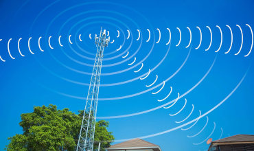
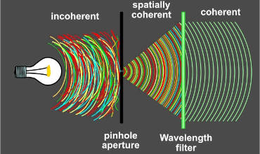
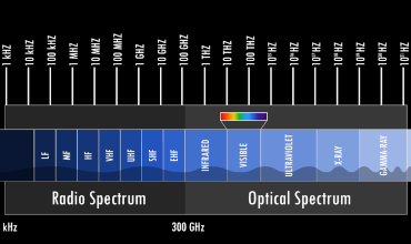
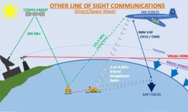
The Global Maritime Distress and Safety System (GMDSS) is an internationally recognized framework designed to enhance marine security by standardizing communication protocols for distress alerts, search and rescue coordination and navigational warnings. Established under the International Maritime Organization (IMO), GMDSS integrates terrestrial and satellite-based technologies to ensure reliable coverage across all seafaring zones. Central to its functionality is the effective utilization of radio wave propagation, which governs the transmission and reception of signals across varying frequencies, such as Very High Frequency (VHF), Medium Frequency (MF) and High Frequency (HF). These frequency bands are selected based on their propagating characteristics, which determine call range, reliability and suitability to specific operational scenarios. For instance, VHF messages rely predominantly on line-of-sight transmission, making them ideal in short-range communication, while HF bands exploit ionospheric reflection to achieve long-distance coverage, critical for transoceanic voyages. Understanding these distribution mechanisms is essential for optimizing GMDSS infrastructure and ensuring seamless communication during emergencies.
Radio Wave Propagation in GMDSS Subsystems
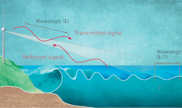
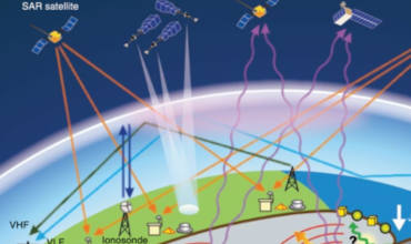
GMDSS employs multiple subsystems, each dependent on distinct radio wave propagation principles. Satellite systems like INMARSAT and COSPAS-SARSAT use geostationary and low-earth orbit satellites, respectively, to enable overall coverage. Signals transmitted to satellites traverse the troposphere and ionosphere, where factors such as atmospheric absorption, solar activity and ionospheric electron density influence call integrity. Terrestrial systems, including Digital Selective Calling (DSC) and NAVTEX, rely on surface-wave and sky-wave circulation. Surface waves (ground waves) follow the Earth’s curvature, enabling MF signals to travel hundreds of nautical miles, while sky-wave circulation allows HF signals to reflect off the ionosphere, extending their reach to thousands of kilometers. Challenges such as ionospheric scintillation, multipath fading and interference from solar flares necessitate adaptive frequency management and redundancy in GMDSS architecture. For example, automated monitoring tools adjust transmission frequencies in real time to mitigate disruptions caused by dynamic radio wave propagation conditions, ensuring continuous operational readiness.
Challenges and Innovations in Radio Wave Propagation for Marine Safety
Despite advancements, radio wave propagation remains susceptible to environmental and geophysical variables, posing risks to GMDSS reliability. Ionospheric storms, caused by solar flares, can degrade HF communications by altering electron density, while ducting effects in the troposphere may cause VHF messages to propagate unpredictably over long distances. To address these issues, modern GMDSS infrastructure incorporates hybrid systems that combine satellite links with terrestrial networks, leveraging the stability of satellite propagation in parallel with HF/VHF redundancy. Emerging technologies, such as software-defined radios (SDRs) and machine learning algorithms, enhance predictive modeling of propagation patterns, enabling preemptive adjustments to communication protocols. Furthermore, research into polar region propagation addresses gaps in traditional sky-wave coverage, vital for Arctic shipping routes. By advancing the understanding of radio wave propagation dynamics and integrating adaptive technologies, GMDSS continues to evolve, ensuring robust world marine safety amid increasingly complex environmental and operational challenges.